Article by Nicholas Ironside – Lead Photographer at ZynQ 360
There are many words that can be used to describe mountains; beautiful, majestic, immense. However, one word which must always be used is respect. Mountains can be some of the most serene and peaceful places to be in the morning and become dangerously inhospitable by the afternoon. A lack of respect for the dangers that can present themselves in mountainous environments has caught many unaware and can lead to disastrous circumstances and a requirement for emergency response. As the great mountaineer, Heinrich Harrer once said:
“Man is small and insignificant in nature’s scheme; but he is part of it. And are we to think less of the man who exposes himself to nature’s forces than of him who just delights in looking at her, safe from dangers and tempests?”
Even the most accomplished climbers are unable to foresee or avert risk 100% of the time. There is an inherent danger with mountaineering and the ever-present risk of global warming is also having an increasing impact on the environment which in turn increases the potential for avalanches, crevasses and rockfall danger. As such, continuous evaluation is integral.
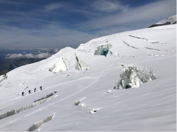
Pollux (Mountain). Image by Nicholas Ironside
Emergency Response
Increased risk, unfortunately, leads to increased accidents. In 2020 there were a total of 3,471 mountain rescues in the Swiss Alps (despite the world experiencing regional and country lockdowns due to the COVID-19 Pandemic). This is an increase from 2,909 in 2019, as reported by the Swiss Alpine Club. This puts huge pressure on mountain rescue teams and emergency services. Identifying a solution to avoid accidents by helping to identify risk, increase rescue success and provide better situational awareness has the potential to save lives. This draws parallels to how our software, ZynQ, is being used in other industries to support and improve planning, safety and emergency response.
How can Zynq help?
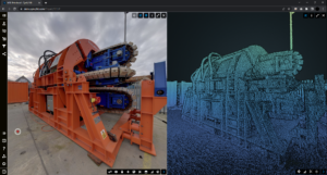
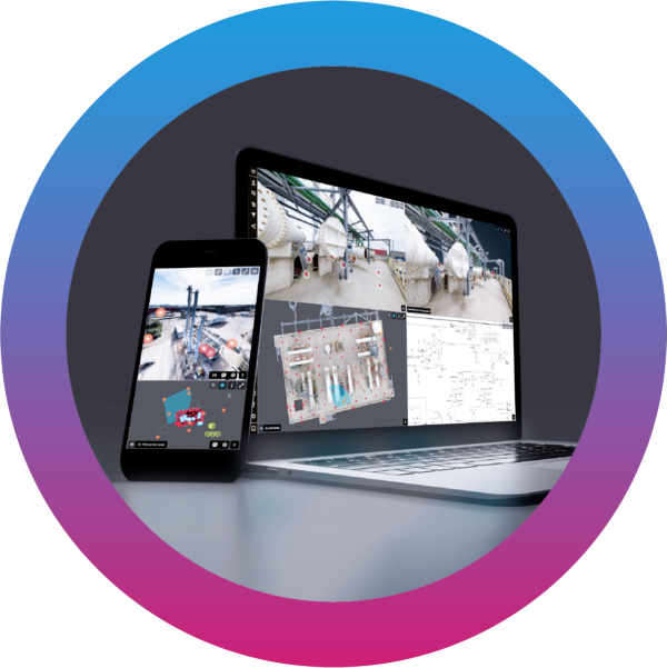
Our dynamic, visualisation technology creates an up to date, 360°, virtual plan of any area, increasing situational awareness and allowing risks and vulnerabilities to be more easily identified and reduced. We can integrate many types of media into our technology such as still photographs, video footage, 3D models, laser scans, drone/aerial footage, text documents and many more.
Identify Risk
There are many dangers to be aware of while mountaineering, some of which are constant, some are seasonal, and others are unexpected. These dangers, including avalanches, crevasses and rockfall cannot be completely avoided but can be monitored and evaluated on a regular basis to better inform both climbers and rescue services.
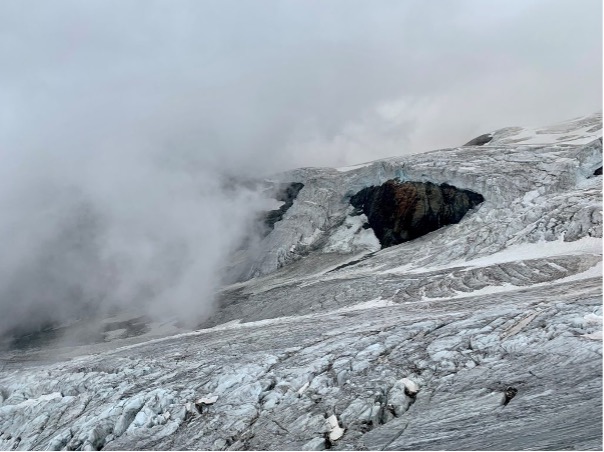
Crevasse’s on Vincent Pyramid. Image by Nicholas Ironside.
By using ZynQ to capture images, both on the ground and in the air, we can create a working project to help continually monitor and highlight areas of concern that can be communicated to guides, rescue teams and made available to the public who are preparing to climb. Specific areas to focus on could include popular climbing routes, known avalanche risk zones and areas of climbing to have notable rockfall or melting ice that could present danger to life.
While not all rescues are down to dangers that can be pre-identified on the mountain, others can be down to a variety of reasons, be it equipment failure, inexperience or altitude sickness. Having the ability to alleviate the pressure put on emergency services and help better prepare climbers prior to any summit attempt can be just as important. For instance, ideal bivouac locations can be identified and highlighted, mountain huts and route finding can be visualised prior to starting a climb and provide essential information which can better prepare climbers for any risks they may encounter.
GIS Locations for Emergency Response
ZynQ’s powerful GIS mapping capabilities allow users to link and overlay information within a global context, with data plotted in real-world coordinates. GIS mapping enables the accurate integration of drone footage and images, photography, 3D models, and other data such as live feeds to be displayed in the correct location.
This has a massive impact on locating and planning a rescue attempt. If the rescue team are provided with correct coordinates to direct them to the person/s in need they can then use ZynQ to survey the area and evaluate how best to attempt a rescue. In addition, they will gain important up to date situational awareness which could lead to a more streamlined approach and possibly save lives in the process while also assessing risk at the same time.
Constantly Evolving
To ensure critical information is always up to date, ZynQ gives users with approved access to upload data in various formats at any time, anywhere. With the multitude of mountain guides, avalanche detection services and rescue teams operating together there is a continuous stream of overlapping information that can be uploaded, daily if required, to keep everyone apprised of the latest risks. This information may ultimately save lives, protecting those climbing in the area and giving greater scope to carry out a successful, informed rescue attempt.
To have the ability to access life-saving information at any time, anywhere and use it to increase safety, awareness and reduce risk is something that many industries can utilise and gain the advantage from.

Want to learn more about how ZynQ 360 can help you optimise your remote operations?
Contact one of our team today
To find out more about ZynQ 360, visit our website here.
To watch a short video introducing ZynQ, our Digital Twin software, click here.